Smart Forest Management and Monitoring System Software (SFMS)
1. Introduction
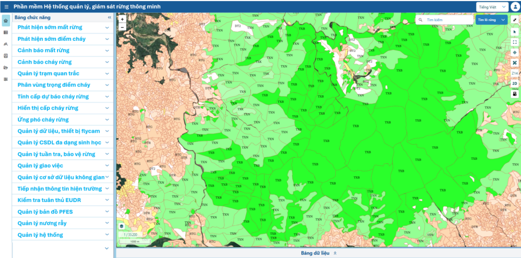
The Smart Forest Monitoring System (SFMS) is an advanced technological solution that integrates artificial intelligence (AI), remote sensing data, and geographic information systems (GIS) to support the management, protection, and development of forest resources. SFMS provides a unified, comprehensive platform for early detection of deforestation, forest fire alerts, fire danger rating calculations and forecasting, as well as managing patrols, unmanned aerial vehicles (drones), and specialized databases. The entire system is accessible to end-users through a WebGIS interface for desktops and a mobile application for smartphones/tablets, ensuring seamless, timely information flow to support effective decision-making, management, and execution of tasks in the forestry sector.
2. Key Benefits of the SFMS System
Implementing SFMS in practice delivers measurable benefits:
- Early Incident Detection and Timely Response: Provides early warnings for deforestation and forest fires with precise location data, reducing the time from detection to response.
- Optimized Human and Material Resources: Assists managers in allocating personnel and equipment efficiently, focusing on high-risk areas to avoid wasting time and effort.
- Standardized and Digitized Processes: Replaces manual reporting, task assignment, and patrolling methods with digitized processes on a single platform, ensuring consistent and efficient operations.
- Transparent Data and Enhanced Accountability: Centralizes and transparently manages data on forest status, alerts, patrols, and tasks, improving accountability for individuals and organizations.
- Evidence-Based Decision-Making: Provides leaders with reliable reports, visualized analytical maps, and data to support informed management and decision-making.
3. Main Modules of the System
The SFMS system consists of independent functional modules, allowing for the deployment of the full solution or specific modules based on the needs of each organization. Each module is designed to address a specific operational challenge, serving as a powerful tool for managers and forest rangers.
3.1. Early Deforestation Detection Using Satellite and Drone Imagery: This module employs AI to automatically analyze and compare time-series remote sensing imagery to detect areas showing signs of deforestation or degradation. It provides managers with precisely geolocated alerts, enabling targeted field inspections instead of broad patrols, transitioning from manual, periodic monitoring to automated, continuous tracking.
3.2. Early Forest Fire Detection Using AI Cameras and Satellite Imagery: This module aggregates and analyzes real-time data from AI cameras (optical and thermal) and global fire alert systems like NASA FIRMS. It delivers instant alerts upon detecting smoke or abnormal heat signatures, even at night or in remote areas, automating 24/7 monitoring and overcoming limitations of manual observation.
3.3. Deforestation Alert Module: When a deforestation alert is generated, this module automatically analyzes the geographic location to identify responsible units and individuals. It instantly sends detailed alerts via multiple channels (email, SMS, mobile app), enabling timely action by managers at all levels, from provincial to local authorities and forest owners, transitioning from manual to automated, real-time reporting.
3.4. Forest Fire Alert Module: Similar to the deforestation alert module, this module ensures fire alerts are sent to the appropriate authorities and units. It provides accurate information on the location, time, source, and reliability of fire detections, enabling rapid mobilization of personnel and resources, a critical factor in firefighting.
3.5. Forest Monitoring Station Management Module: This module serves as a hub for collecting and managing data from automated field monitoring stations. It continuously gathers weather data (temperature, humidity, rainfall) for fire danger rating calculations and manages video feeds from surveillance cameras. This tool allows remote monitoring of weather conditions and security in key areas, reducing the need for on-site presence.
3.6. Forest Fire Risk Zoning Module: This module performs complex spatial analysis, overlaying data layers such as fire history, multi-year climate conditions, forest types, terrain, and proximity to settlements. The result is a digital map categorizing areas by fire risk levels, serving as a strategic reference for policymakers and local leaders to allocate fire prevention resources scientifically.
3.7. Automated Fire Danger Rating Display Module: This interface module visually presents fire danger rating calculations (Levels I to V) on WebGIS and mobile apps, making it easy for users, from the public to leaders, to understand risk levels. For units with mechanical fire indicator boards, the module can integrate with IoT to control automated needle adjustments, exemplifying digital transformation.
3.8. Forest Fire Response and Command Support Module: During a fire, commanders can input real-time parameters (fire extent, wind direction, etc.) into the system. Based on predefined rules, this module suggests response scenarios, recommending personnel, equipment, and firefighting tactics, acting as a virtual assistant in emergencies.
3.9. Automated Daily Fire Danger Rating Calculation Module: This core module automatically calculates fire danger ratings daily at 1:00 PM using standard formulas (e.g., Nesterov’s P index). It draws data from system monitoring stations or international weather forecasts, eliminating human error and ensuring consistent, synchronized daily updates.
3.10. Drone Data and Equipment Management Module: Designed as a digital “warehouse,” this module manages the lifecycle of drones, tracking their status, maintenance history, flight permits, and related records. It also allows users to upload, store, review, and download drone imagery, serving as input for the early deforestation detection module and digitizing drone data management.
3.11. Biodiversity Database Management Module: A specialized tool for conservation and research, this module enables organizations to create, update, and query information on flora and fauna. It systematizes biodiversity knowledge, transitioning from scattered records to a centralized, easily accessible digital database.
3.12. Forest Patrol and Protection Management Module: This module digitizes the patrol process, recording movement tracks and field events from multiple sources (GPS, SMART, mobile app). It enables transparent monitoring and evaluation of patrol effectiveness while providing rangers with a modern reporting tool, replacing paper records.
3.13. Task Management Module: This module offers a centralized platform for leaders to create, assign, and track task progress. It standardizes workflows, from verifying alerts to implementing patrol plans, enhancing accountability and providing managers with a comprehensive overview of their unit’s tasks.
3.14. Spatial Database Management Module: The core GIS infrastructure module, acting as a map server, allows administrators to upload, store, customize (colors, symbols), and publish map data layers (vector, raster) in international standards (e.g., WMS, WFS). It ensures consistent, accurate base map data for all modules and third-party software.
3.15. Mobile Application Module: A comprehensive “mobile office” for field users, this app integrates key functions like offline base map viewing, GPS-based measurements, area delineation, and calculations. It enables users to receive tasks, verify alerts, and create reports directly from the field.
3.16. Community Field Information Collection Module: This module facilitates two-way interaction with the public, allowing citizens to report forest fires, deforestation, or violations via a simple web or mobile interface. Reports require field photos for authenticity, leveraging community participation to create a broad network of informants for authorities.
3.17. EUDR Deforestation Regulation Compliance Check Module: A specialized module for transparent verification, it allows users to locate their land plots and cross-check them against forest status maps as of December 31, 2020, and global deforestation data. It provides instant compliance assessments with the EU Deforestation Regulation (EUDR), supporting product traceability.
3.18. Forest Environmental Services Payment Map Management Module: A central GIS module designed to digitize and enhance transparency in managing forest environmental services payment data. It provides administrators with tools to customize and publish payment maps and offers a portal for communities and contractors to access information on assigned forest plots and payments, ensuring accuracy and trust.
3.19. Shifting Cultivation Management Module: A specialized monitoring module, it helps managers track and control shifting cultivation areas within forestry land plans. It manages registered plot databases and uses AI to periodically analyze satellite imagery, automatically detecting and alerting unauthorized expansions or encroachments, enabling timely interventions.
3.20. System Management Module: The central administrative module, it enables system administrators to perform critical tasks such as creating and managing user accounts, assigning detailed permissions to ensure only authorized personnel access sensitive functions, and performing backup and recovery processes to safeguard system data.
4. Copyright Notice
The Smart Forest Management and Monitoring System (SFMS) is co-owned by Đồng Xanh Consulting and Development Co., Ltd. and Đồng Xanh Consulting and Technology Co., Ltd. The product can be provided as a complete solution or in parts based on the specific needs of each organization. SFMS is commercial software, offered to clients under a license model with customizable features to meet customer requirements.
5. Contact Information
We are committed to supporting forestry organizations in their digital transformation journey, contributing to the effective management and sustainable protection of forest resources. To learn more about the solution or request a live demonstration of the SFMS system, please contact:
Mr. Vũ Văn Thái
Mobile: 08549892929
Email: thai.vv@gfd.com.vn
Media Coverage on the Smart Forest Monitoring Software
Bình Thuận Protects Forests Using Remote Sensing Technology (Thanh Niên Newspaper)
Vĩnh Phúc Applies High-Tech Solutions for Forest Management and Protection (Thanh Niên Newspaper)
Effective Forest Resource Monitoring in Bình Thuận (Nhân Dân Newspaper)
Detection of Illegal Cannabis Cultivation Through Remote Sensing (VNExpress)
Digital Technology Applications in Forest Management and Protection (Vietnamnet)
Quảng Nam Uses High-Tech Solutions for Forest Protection (VTV)
Quảng Nam Applies Technology in Forest Management and Protection (Region 4 Forest Protection Agency)
CFMS Technology Application in Forest Monitoring and Protection in Vietnam (Environmental Protection Newspaper)
Vĩnh Phúc Adopts High-Tech Solutions for Forest Management and Protection (Nhân Dân Newspaper)
Promoting Digital Technology in Forest Management and Protection (Vĩnh Phúc Provincial People’s Committee Website)